de/GPXViewer


Info / Download

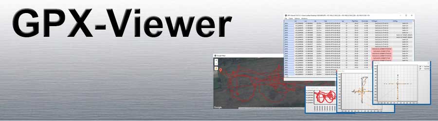
The GPX viewer is a simple program with which it is possible to view the GPX log files recorded by the MikroKopter.
All telemetry data are recorded in these log files during a flight.

  • The GPX viewer functions at a glance

    • Display of all telemetry data of the copter
    • Errors are highlighted in color
    • Problematic values are highlighted in color (e.g. Magnetic field deviations)
    • Status bits of the MK are evaluated
    • GPX file can be exported to Google Earth
    • Additional information from the GPX file can be displayed (e.g. setting info, license info, firmware info)
    • Data are given units and converted if necessary
    • You can create your own graph from the values
    • The columns can be moved
    • Geo data can be exported for Agisoft Photoscan and Pix4D


  • The program GPX-Viewer can be downloaded here: Download


download GPX Logfile

http://gallery3.mikrokopter.de/var/albums/intern/GPX-Viewer/GPX_Download.jpg?m=1528115643


To download the .gpx Log connect your MikroKopter with your Computer
and start the KopterTool. Here "click" on the Button SD Card....
Here the required .gpx log file of the flight can be selected and saved on the computer.

{i} Larger files may take a few minutes to download.
If you want to access the log data faster, you can also remove the SD card from the copter and read it out directly with the PC.


The Menü

http://gallery3.mikrokopter.de/var/albums/intern/GPX-Viewer/GPX-Viewer-File.jpg?m=1447683654

File

  • Open GPX
    -> To open a log file in * .GPX format

    Save GPX
    -> To save a log file

    Show GPX
    -> Shows information about the opened log file such as error messages etc.

    Open in Google Earth
    -> Opens Google Earth and shows the flight graphically.

    Connect altitude to Ground in GE
    -> If this option is activated, the height is marked in Google Earth with lines perpendicular to the ground.

    Use raw GPS altitude
    -> If this option is activated, the altitude calculated by the GPS is entered for the export to Google Earth and not that of the air pressure sensor.

    Create photo logfile ...
    -> To create an export file for Agisoft Photoscan and Pix4D

    Open in Texteditor ...
    -> The GPX file is opened in a text editor

    Exit
    -> Closes the GPX viewer


http://gallery3.mikrokopter.de/var/albums/intern/GPX-Viewer/GPX-Viewer-Charts.jpg?m=1447750001

Charts

  • Add user chart
    -> If you have created your own graphs / charts, they can be added here.

    Select chart files
    -> Show charts from the directory of the GPX viewer


http://gallery3.mikrokopter.de/var/albums/intern/GPX-Viewer/GPX-Viewer-Options.jpg?m=1447683654

Options

  • Parse data
    -> Measured values are adjusted for the GPX viewer for better display.

    Google Maps View
    -> Measured values are adjusted for the GPX viewer for better display.

    Auto jump to error line
    -> If there is an error in the log, the GPX viewer automatically jumps to the location of the first error.

    Prev
    -> Jump to the previous error Next
    -> Jump to the next error


http://gallery3.mikrokopter.de/var/albums/intern/GPX-Viewer/GPX-Viewer-Windows.jpg?m=1447683655

Windows

  • Show all Charts ...
    -> Show all charts

    Hide all Charts ...
    -> Hide all charts

    Strom

  • .

  • .

  • .

    X-Achse = Strom

    -> If all "charts" are hidden, the individual charts can be displayed here.


The GPX log file

http://gallery3.mikrokopter.de/var/albums/intern/GPX-Viewer/GPX-Viewer-Lat.jpg?m=1447689117
http://gallery3.mikrokopter.de/var/albums/intern/GPX-Viewer/GPX-Viewer-Lat2.jpg?m=1447689117
Latitude value
in decimal degrees

http://gallery3.mikrokopter.de/var/albums/intern/GPX-Viewer/GPX-Viewer-Lon.jpg?m=1447689118
http://gallery3.mikrokopter.de/var/albums/intern/GPX-Viewer/GPX-Viewer-Lon2.jpg?m=1447689118
Longitude value
in decimal degrees

http://gallery3.mikrokopter.de/var/albums/intern/GPX-Viewer/GPX-Viewer-ele.jpg?m=1447688996
http://gallery3.mikrokopter.de/var/albums/intern/GPX-Viewer/GPX-Viewer-ele2.jpg?m=1447689025
Altitude value from the GPS module

http://gallery3.mikrokopter.de/var/albums/intern/GPX-Viewer/GPX-Viewer-time.jpg?m=1447689251
http://gallery3.mikrokopter.de/var/albums/intern/GPX-Viewer/GPX-Viewer-time2.jpg?m=1447689252
UTC time from the GPS module

http://gallery3.mikrokopter.de/var/albums/intern/GPX-Viewer/GPX-Viewer-sat.jpg?m=1447689207
http://gallery3.mikrokopter.de/var/albums/intern/GPX-Viewer/GPX-Viewer-sat2.jpg?m=1447689207
Number of satellites received

http://gallery3.mikrokopter.de/var/albums/intern/GPX-Viewer/GPX-Viewer-FlightTime.jpg?m=1447689055
http://gallery3.mikrokopter.de/var/albums/intern/GPX-Viewer/GPX-Viewer-FlightTime2.jpg?m=1447689055
Flight time in minutes: seconds

http://gallery3.mikrokopter.de/var/albums/intern/GPX-Viewer/GPX-Viewer-ErrorCode.jpg?m=1447689025
http://gallery3.mikrokopter.de/var/albums/intern/GPX-Viewer/GPX-Viewer-ErrorCode2.jpg?m=1447689025
Display of the various ErrorCodes

http://gallery3.mikrokopter.de/var/albums/intern/GPX-Viewer/GPX-Viewer-FCFlags2.jpg?m=1447689054
http://gallery3.mikrokopter.de/var/albums/intern/GPX-Viewer/GPX-Viewer-FCFlags22.jpg?m=1447689054
Current FlightCtrl status

http://gallery3.mikrokopter.de/var/albums/intern/GPX-Viewer/GPX-Viewer-NCFlag.jpg?m=1447689166
http://gallery3.mikrokopter.de/var/albums/intern/GPX-Viewer/GPX-Viewer-NCFlag2.jpg?m=1447689166
Current GPS status

http://gallery3.mikrokopter.de/var/albums/intern/GPX-Viewer/GPX-Viewer-Speak.jpg?m=1447689229
http://gallery3.mikrokopter.de/var/albums/intern/GPX-Viewer/GPX-Viewer-Speak2.jpg?m=1447689229
Voice output HoTT telemetry

http://gallery3.mikrokopter.de/var/albums/intern/GPX-Viewer/GPX-Viewer-Altimeter.jpg?m=1447688906
http://gallery3.mikrokopter.de/var/albums/intern/GPX-Viewer/GPX-Viewer-Altimeter2.jpg?m=1447688906
Barometric altitude
measured by the air pressure sensor

http://gallery3.mikrokopter.de/var/albums/intern/GPX-Viewer/GPX-Viewer-Variometer.jpg?m=1447689252
http://gallery3.mikrokopter.de/var/albums/intern/GPX-Viewer/GPX-Viewer-Variometer2.jpg?m=1447689253
Rate of climb of the copter (in m/s)

http://gallery3.mikrokopter.de/var/albums/intern/GPX-Viewer/GPX-Viewer-Voltage.jpg?m=1447689269
http://gallery3.mikrokopter.de/var/albums/intern/GPX-Viewer/GPX-Viewer-Voltage2.jpg?m=1447689269
Voltage of the LiPo
(in Volt)

http://gallery3.mikrokopter.de/var/albums/intern/GPX-Viewer/GPX-Viewer-Current.jpg?m=1447688995
http://gallery3.mikrokopter.de/var/albums/intern/GPX-Viewer/GPX-Viewer-Current2.jpg?m=1447688995
LiPo-Current
(in Ampere)

http://gallery3.mikrokopter.de/var/albums/intern/GPX-Viewer/GPX-Viewer-Capacity.jpg?m=1447688960
http://gallery3.mikrokopter.de/var/albums/intern/GPX-Viewer/GPX-Viewer-Capacity2.jpg?m=1447688960
Consumed capacity
(in mAh)

http://gallery3.mikrokopter.de/var/albums/intern/GPX-Viewer/GPX-Viewer-Compass.jpg?m=1447688961
http://gallery3.mikrokopter.de/var/albums/intern/GPX-Viewer/GPX-Viewer-Compass2.jpg?m=1447688961
1: Yaw Gyro Stabilized Compass Value
2: Compass raw value
3: Compass Setpoint
4: Corrected compass value (declination)

http://gallery3.mikrokopter.de/var/albums/intern/GPX-Viewer/GPX-Viewer-MagnetField.jpg?m=1447689142
http://gallery3.mikrokopter.de/var/albums/intern/GPX-Viewer/GPX-Viewer-MagnetField2.jpg?m=1447689142
Strength of the magnetic field in %.
Value should be ~ 100%

http://gallery3.mikrokopter.de/var/albums/intern/GPX-Viewer/GPX-Viewer-MagnetInclination.jpg?m=1447689142
http://gallery3.mikrokopter.de/var/albums/intern/GPX-Viewer/GPX-Viewer-MagnetInclination2.jpg?m=1447689142
The first value shows the inclination of the vector from the magnetic compass. The second value indicates the calculated error compared to the theoretical value of the location

http://gallery3.mikrokopter.de/var/albums/intern/GPX-Viewer/GPX-Viewer-NickAngle.jpg?m=1447689167
http://gallery3.mikrokopter.de/var/albums/intern/GPX-Viewer/GPX-Viewer-NickAngle2.jpg?m=1447689167
Pitch angle
(in Grad)

http://gallery3.mikrokopter.de/var/albums/intern/GPX-Viewer/GPX-Viewer-RollAngle.jpg?m=1447689186
http://gallery3.mikrokopter.de/var/albums/intern/GPX-Viewer/GPX-Viewer-RollAngle2.jpg?m=1447689187
Roll angle
(in Grad)

http://gallery3.mikrokopter.de/var/albums/intern/GPX-Viewer/GPX-Viewer-M1_current.jpg?m=1528192966
http://gallery3.mikrokopter.de/var/albums/intern/GPX-Viewer/GPX-Viewer-M1_current2.jpg?m=1528192966
Display of the individual motor currents

http://gallery3.mikrokopter.de/var/albums/intern/GPX-Viewer/GPX-Viewer-BL1_Temp.jpg?m=1528192964
http://gallery3.mikrokopter.de/var/albums/intern/GPX-Viewer/GPX-Viewer-BL1_Temp2.jpg?m=1528192966
Display temperature of the individual motor controllers

http://gallery3.mikrokopter.de/var/albums/intern/GPX-Viewer/GPX-Viewer-MotorNOK.jpg?m=1447689166
http://gallery3.mikrokopter.de/var/albums/intern/GPX-Viewer/GPX-Viewer-MotorNOK2.jpg?m=1447689166
Motor fault counter
Motor1, ... Motor8

http://gallery3.mikrokopter.de/var/albums/intern/GPX-Viewer/GPX-Viewer-AvaiableMotorPower.jpg?m=1447688907
http://gallery3.mikrokopter.de/var/albums/intern/GPX-Viewer/GPX-Viewer-AvaiableMotorPower2.jpg?m=1447688907
Available energy of the motor controller (0-100%)

http://gallery3.mikrokopter.de/var/albums/intern/GPX-Viewer/GPX-Viewer-Gas.jpg?m=1447689090
http://gallery3.mikrokopter.de/var/albums/intern/GPX-Viewer/GPX-Viewer-Gas2.jpg?m=1447689091
First value: current GAS value
Second value: Calculated value for floating gas

http://gallery3.mikrokopter.de/var/albums/intern/GPX-Viewer/GPX-Viewer-FC_I2C_ErrorCounter.jpg?m=1447689026
http://gallery3.mikrokopter.de/var/albums/intern/GPX-Viewer/GPX-Viewer-FC_I2C_ErrorCounter2.jpg?m=1447689026
Error counter for I²C bus

http://gallery3.mikrokopter.de/var/albums/intern/GPX-Viewer/GPX-Viewer-FC_SPI_ErrorCounter.jpg?m=1447689053
http://gallery3.mikrokopter.de/var/albums/intern/GPX-Viewer/GPX-Viewer-FC_SPI_ErrorCounter2.jpg?m=1447689053
Error counter for SPI bus

http://gallery3.mikrokopter.de/var/albums/intern/GPX-Viewer/GPX-Viewer-AnalogInputs.jpg?m=1447688906
http://gallery3.mikrokopter.de/var/albums/intern/GPX-Viewer/GPX-Viewer-AnalogInputs2.jpg?m=1447688906
Analog inputs from the NC
(1024 = 3,3V)

http://gallery3.mikrokopter.de/var/albums/intern/GPX-Viewer/GPX-Viewer-Servo.jpg?m=1447689208
http://gallery3.mikrokopter.de/var/albums/intern/GPX-Viewer/GPX-Viewer-Servo2.jpg?m=1447689208
First value: Setpoint Nick Servo in degrees
Second value: Setpoint Roll Servo in degrees
Third value: waypoint nick setpoint in degrees

http://gallery3.mikrokopter.de/var/albums/intern/GPX-Viewer/GPX-Viewer-WP.jpg?m=1447689270
http://gallery3.mikrokopter.de/var/albums/intern/GPX-Viewer/GPX-Viewer-WP2.jpg?m=1447689270
First value: Name of the current destination waypoint (e.g. P12)
Second value: Number of the current destination waypoint
Third value: total number of waypoints
Fourth value: Current value of the WP event

http://gallery3.mikrokopter.de/var/albums/intern/GPX-Viewer/GPX-Viewer-ShutterCnt.jpg?m=1447689209
http://gallery3.mikrokopter.de/var/albums/intern/GPX-Viewer/GPX-Viewer-ShutterCnt2.jpg?m=1447689209
Counter for switching output OUT1

http://gallery3.mikrokopter.de/var/albums/intern/GPX-Viewer/GPX-Viewer-TargetBearing.jpg?m=1447689230
http://gallery3.mikrokopter.de/var/albums/intern/GPX-Viewer/GPX-Viewer-TargetBearing2.jpg?m=1447689231
Angle from the copter to the target

http://gallery3.mikrokopter.de/var/albums/intern/GPX-Viewer/GPX-Viewer-TargetDistance.jpg?m=1447689231
http://gallery3.mikrokopter.de/var/albums/intern/GPX-Viewer/GPX-Viewer-TargetDistance2.jpg?m=1447689231
Distance from the copter to the target

http://gallery3.mikrokopter.de/var/albums/intern/GPX-Viewer/GPX-Viewer-Course.jpg?m=1447688994
http://gallery3.mikrokopter.de/var/albums/intern/GPX-Viewer/GPX-Viewer-Course2.jpg?m=1447688995
GPS course over ground
(regardless of the compass value)

http://gallery3.mikrokopter.de/var/albums/intern/GPX-Viewer/GPX-Viewer-GroundSpeed.jpg?m=1447689116
http://gallery3.mikrokopter.de/var/albums/intern/GPX-Viewer/GPX-Viewer-GroundSpeed2.jpg?m=1447689117
Basic speed of the copter (in cm/s)

http://gallery3.mikrokopter.de/var/albums/intern/GPX-Viewer/GPX-Viewer-VerticalSpeed.jpg?m=1447689253
http://gallery3.mikrokopter.de/var/albums/intern/GPX-Viewer/GPX-Viewer-VerticalSpeed2.jpg?m=1447689253
Vertical speed of the copter (in cm/s)

http://gallery3.mikrokopter.de/var/albums/intern/GPX-Viewer/GPX-Viewer-RCSticks.jpg?m=1447689186
http://gallery3.mikrokopter.de/var/albums/intern/GPX-Viewer/GPX-Viewer-RCSticks2.jpg?m=1447689186Current values of the RC sticks in the following order: Nick; Roll ; Yaw ; Gas ; Ch5, ... Ch16

http://gallery3.mikrokopter.de/var/albums/intern/GPX-Viewer/GPX-Viewer-GPSSticks.jpg?m=1447689091
http://gallery3.mikrokopter.de/var/albums/intern/GPX-Viewer/GPX-Viewer-GPSSticks2.jpg?m=1447689091
Influence of the GPS mode on the RC sticks in the following order:
Nick, Roll, Yaw, GPS-Mode
GPS-Modes:
'-' = no GPS fix
'/' = OFF
'?' = Coming home, home position unknown (PositionHold is activated instead)
'H' = Coming home
'W' = Waypoint flight
'D' = Dynamic Position Hold
'P' = Position Hold
'm' = manual control

http://gallery3.mikrokopter.de/var/albums/intern/GPX-Viewer/GPX-Viewer-RCQuality.jpg?m=1447689185
http://gallery3.mikrokopter.de/var/albums/intern/GPX-Viewer/GPX-Viewer-RCQuality2.jpg?m=1447689186
Quality of the PPM signal
(NOT the signal strength of the receiver)

http://gallery3.mikrokopter.de/var/albums/intern/GPX-Viewer/GPX-Viewer-ele_raw-01.jpg?m=1528192966
http://gallery3.mikrokopter.de/var/albums/intern/GPX-Viewer/GPX-Viewer-ele_raw2.jpg?m=1447689025
Raw GPS Altitude in m

http://gallery3.mikrokopter.de/var/albums/intern/GPX-Viewer/GPX-Viewer-GPSInfo.jpg?m=1447689091
http://gallery3.mikrokopter.de/var/albums/intern/GPX-Viewer/GPX-Viewer-GPSInfo2.jpg?m=1447689091
1: GPS update rate in 0.1Hz (50 = 5,0Hz)
2: GPSData_Flags
3: Sat-fix


Charts / Graphen

You can graphically display certain values of the recorded flight separately in a separate window.
These are opened automatically when the program starts. All windows can also be closed under the "Windows" tab and only individual graphs can be displayed.

The following charts are already included with the GPX viewer:

Altitude
http://gallery3.mikrokopter.de/var/albums/intern/GPX-Viewer/GPX-Viewer-Chart-Altitude-H%C3%B6he.jpg?m=1447683152

BL-Ctrl Temperatures
http://gallery3.mikrokopter.de/var/albums/intern/GPX-Viewer/GPX-Viewer-Chart-BL-CtrlTemperatur.jpg?m=1447683153

Compass
http://gallery3.mikrokopter.de/var/albums/intern/GPX-Viewer/GPX-Viewer-Chart-Compass.jpg?m=1447683153

Throttle/Yaw
http://gallery3.mikrokopter.de/var/albums/intern/GPX-Viewer/GPX-Viewer-Chart-GasGier.jpg?m=1447683153

GroundSpeed
http://gallery3.mikrokopter.de/var/albums/intern/GPX-Viewer/GPX-Viewer-Chart-GroundSpeed.jpg?m=1447683154

Nick/Roll
http://gallery3.mikrokopter.de/var/albums/intern/GPX-Viewer/GPX-Viewer-Chart-Nick-Roll.jpg?m=1447683180

OUT1+2
http://gallery3.mikrokopter.de/var/albums/intern/GPX-Viewer/GPX-Viewer-Chart-Out1%2B2.jpg?m=1447683181

StickGAS/Altitude
http://gallery3.mikrokopter.de/var/albums/intern/GPX-Viewer/GPX-Viewer-Chart-StickGas-Altitude.jpg?m=1447683181

Current
http://gallery3.mikrokopter.de/var/albums/intern/GPX-Viewer/GPX-Viewer-Chart-Strom.jpg?m=1447683182

WP-Event
http://gallery3.mikrokopter.de/var/albums/intern/GPX-Viewer/GPX-Viewer-Chart-WP-Event.jpg?m=1447683182

X-Achse-Current
http://gallery3.mikrokopter.de/var/albums/intern/GPX-Viewer/GPX-Viewer-Chart-X-AchseStrom.jpg?m=1447683183

Voltage
http://gallery3.mikrokopter.de/var/albums/intern/GPX-Viewer/GPX-Viewer-Chart-Voltage.jpg?m=1447683216


Create your own graph

If you want to display certain values in a separate window, you can do this via an extra ".ini" file.
The name of the ".ini" file must then start with "Charts-" and be in the same folder as the "GPX-Viewer.exe".

  • Example: Display capacity over flight time
    If you want to display the capacity over the flight time, the file can be called "Charts-Capacity.ini".
    The content can look like this:

    • [Chart1]
      ChartName = "mAh"
      Series1Ident = "Capacity"
      Series1Name = "mAh"

    The display would then look like this:

    http://gallery.mikrokopter.de/main.php/v/tech/SimpleGpxViewer2.gif.html


Export geospatial data

With the current version of the GPX viewer it is possible to export the appropriate geodata for Pix4D and Agisoft Photoscan.

To do this, proceed as follows:

  • click in the GPX-Viewer ->Create photo logfile...

http://gallery3.mikrokopter.de/var/resizes/intern/GPX-Viewer/GPX_viewer_menu.jpg?m=1446123587

In the following window you select the line on which the first photo was triggered. You can recognize this by the column [ShutterCnt]

http://gallery3.mikrokopter.de/var/resizes/intern/GPX-Viewer/GPX_viewer_photolog.jpg?m=1446123670

Directly below you select the first photo that was created by the waypoint flight.

Now you have to give the output file a name and select the 3D program for which the file is to be created. If you click on "Start ..." the export file is created.

From here the respective programs continue.

Agisoft Photoscan


http://gallery3.mikrokopter.de/var/resizes/intern/GPX-Viewer/Agisoft_import.jpg?m=1446452643

If the photos have been loaded into Agisoft Photoscan, click on the symbol for importing the geographic information in the "Reference" tab.


http://gallery3.mikrokopter.de/var/resizes/intern/GPX-Viewer/Agisoft_import_2.jpg?m=1446452794

Here the program already offers the option of selecting the format in which the import file is available.

Pix4D


http://gallery3.mikrokopter.de/var/resizes/intern/GPX-Viewer/Pix4d_menu_05.jpg?m=1446123170

If you have loaded photos into Pix4D without geo information, this will be displayed


http://gallery3.mikrokopter.de/var/resizes/intern/GPX-Viewer/Pix4d_menu_06.jpg?m=1446123171

With a click on "From File ..." the file generated by the GPX viewer can be read in. Once this is done you will see a green tick as confirmation.